Subscribe To Beau Dodson Weather

WeatherTalk App

Receive Beau Dodson's personally crafted and written alerts directly to your phone, plus gain access to BDW digital media blog.  Completely tailored weather products for all situations
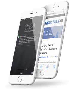
Bear Hugs for the Heart

Shadow Angel Foundation

The Shadow Angel Foundation is a non-profit charity serving children and families affected by traumatic events, from natural disasters to poverty and abuse. We serve our community through a variety of growing projects, like our flagship Teddy Bear Drive and others.

FACEBOOK, TWITTER, INSTAGRAM & YOUTUBE

Genuine Connections

Forge new friendships and view the latest weather information along side like-minded individuals from across the region.

Beau’s exclusive, real-time weather notifications

WEATHER TALK APP  

Whether you are a teacher, coach, parent, farmer, or just need to know the forecast for your weekend plans, Beau Dodson Weather has tailored weather products for all situations.  

When severe and winter weather hit, there’s no time to delay. Give yourself and your loved ones the gift of advanced warning and detailed forecasts, customized to your area. A simple notification could mean all the difference in the world!

N

Notice of Severe Weather and Winter Storms Approaching

These are possibly the most important messages to receive. Get updates from Beau before and during significant weather events. Even when the television signal goes out or you’re away from home, Beau will be there.

N

Daily Weather Updates

Wondering how to dress for the weather? Thinking of having a barbecue tonight? Wondering if there’s snow and ice heading your way? Beau knows, and he’s got you covered!

N

Social Media Notifications

Receive an immediate notification when Beau makes important posts about severe weather and winter storms on his Facebook page and WeatherTalk blog.

Beau Dodson Weather Talk APP

TAILORED CONTENT

Personal Notifications

sent directly to your phone. Beau Dodson is making it easier than ever to stay on top of the weather that matters most to you.

Continuous Eye On Weather

will work to let you know where severe weather was last spotted in your area.

Unlike Weather Apps

that rely on computer-generated predictions, this app service is like having a direct link to one of the area’s best meteorologists.

Convenient App Messages

work to supplement and expand upon the standard alerts you likely receive from the National Weather Service, including those warning of severe weather events in your area.

Weather Notifications

can be sent to up to five phone numbers.

Keep Your Loved Ones Safe

and alert by providing them with this invaluable gift! No one should be left to weather the storm alone. Beau’s exclusive, real-time weather notifications are powered by The Fire Horn.

Beau Dodson – Weather Services

Tools, Content & Merchandise

At Beau Dodson Weather, we are dedicated to keeping you informed and prepared for all weather conditions. Our comprehensive suite of services ensures you have the most accurate and up-to-date weather information right at your fingertips!

BDW Alerts Sent Directly to Your Phone!

Online Regional and Interactive Radars.

BDW Official Weather Merchandise!

Meet The Team That Has You Covered.

BDW History Timeline & Photos.

Beau Dodson – Social Feeds

Facebook, Twitter, Instagram & Youtube

 Genuine Connections: Forge new friendships and view the latest weather information along side like-minded individuals from across the region.

Facebook

Cover for Beau Dodson Weather
63
Beau Dodson Weather

Beau Dodson Weather

When the weather becomes personal! Beau Dodson is a degreed broadcast meteorologist. Bachelor of Science degree. Serving southeast Missouri, southern Illinois, western Kentucky, and northwest Tennessee.

Comments Box SVG iconsUsed for the like, share, comment, and reaction icons

Sunday, March 30, 2025
12 PM Update.
❓ Severe Weather Question and Answer Thread

HIT SHARE and invite your friends to the weather page.

Analysis and reports thread.

We will be looking for storm reports.

Wind damage, tornadoes, and hail reports. Compare hail to coins or objects. Photos are helpful. Let me know the city and county (time of event, as well).

🌩️ Severe thunderstorms are likely this afternoon and tonight 🌩️

⚠️ Confidence in today's forecast: High.

Thunderstorms will develop this afternoon into tonight.

Review your severe weather safety plans. Be ready to seek shelter if severe storms develop.

I will keep this thread updated.

Warnings will be sent out via the www.weathertalk.com app and on WeatherCall
weathercallservices.com/beau-dodson-weather

I will likely try not to clutter this thread with every warning. Unless it is something significant.

I will post analysis updates in this thread.

⚠️ The primary concern will be golf ball size hail or larger, a few reports of 70 mph wind, and a few tornadoes.

Please make sure you have three or more ways to receive severe weather alerts.

The Beau Dodson Weather App is one of those ways. WeatherCall is another.

Sign up for my app messages at www.weathertalk.com and then download the app from the app store.

Apple users: Beau Dodson Weather App
wtalk.co/9EZYG8A8

Android users: Beau Dodson Weather App
wtalk.co/ZEWYU8ME

🌪️ NEW SERVICE 🌪️ I have partnered with WeatherCall to bring you an added layer of protection.

We also have a new service to complement your www.weathertalk.com subscription. This does NOT replace www.weathertalk.com It is simply another tool that allows you to receive severe weather warnings.

I use it myself.

🚨 I encourage everyone to have 3 to 5 ways of receiving severe weather information. All sources can fail, and the more sources you have, the better prepared you will be in the event of severe weather warnings.

WeatherCall will call your cell phone or home number if your home is in a tornado or severe thunderstorm warning. It only calls you if your home is inside the warning box. If you are outside the warning box, it will not disturb you.

More information on the WeatherCall subscription service is here.

weathercallservices.com/beau-dodson-weather

YouTube Video
www.youtube.com/watch?v=ohcPP5q8JzU

What the tornado warning sounds like
youtu.be/ohcPP5q8JzU?si=EXu2ToNOD0xGi5KW&t=49
... See MoreSee Less

Sunday, March 30, 2025
12 PM Update.
❓ Severe Weather Question and Answer Thread

HIT SHARE and invite your friends to the weather page.

Analysis and reports thread.

We will be looking for storm reports.  

Wind damage, tornadoes, and hail reports.  Compare hail to coins or objects.  Photos are helpful.  Let me know the city and county (time of event, as well).

🌩️ Severe thunderstorms are likely this afternoon and tonight 🌩️

⚠️ Confidence in todays forecast: High.

Thunderstorms will develop this afternoon into tonight.

Review your severe weather safety plans.  Be ready to seek shelter if severe storms develop.

I will keep this thread updated.  

Warnings will be sent out via the www.weathertalk.com app and on WeatherCall
https://weathercallservices.com/beau-dodson-weather

I will likely try not to clutter this thread with every warning.  Unless it is something significant.

I will post analysis updates in this thread.

⚠️ The primary concern will be golf ball size hail or larger, a few reports of 70 mph wind, and a few tornadoes.

Please make sure you have three or more ways to receive severe weather alerts.

The Beau Dodson Weather App is one of those ways.  WeatherCall is another.

Sign up for my app messages at www.weathertalk.com and then download the app from the app store.

Apple users: Beau Dodson Weather App
https://wtalk.co/9EZYG8A8

Android users: Beau Dodson Weather App
https://wtalk.co/ZEWYU8ME

🌪️ NEW SERVICE 🌪️  I have partnered with WeatherCall to bring you an added layer of protection.

We also have a new service to complement your  www.weathertalk.com subscription.  This does NOT replace  www.weathertalk.com   It is simply another tool that allows you to receive severe weather warnings.  

I use it myself.  

🚨 I encourage everyone to have 3 to 5 ways of receiving severe weather information.  All sources can fail, and the more sources you have, the better prepared you will be in the event of severe weather warnings.

WeatherCall will call your cell phone or home number if your home is in a tornado or severe thunderstorm warning.  It only calls you if your home is inside the warning box.  If you are outside the warning box, it will not disturb you.  

More information on the WeatherCall subscription service is here.

https://weathercallservices.com/beau-dodson-weather

YouTube Video
https://www.youtube.com/watch?v=ohcPP5q8JzU

What the tornado warning sounds like
https://youtu.be/ohcPP5q8JzU?si=EXu2ToNOD0xGi5KW&t=49

Sunday, March 30, 2025
6 AM Update.

HIT SHARE and invite your friends to the weather page.

❓ Severe Weather Question and Answer Thread

🌩️ Severe thunderstorms are likely this afternoon and tonight 🌩️

🌩️ Severe Thunderstorms are likely on Wednesday 🌩️

🌩️ Locally heavy rain over the next six days will lead to flooding issues 🌩️

⚠️ Confidence in today's forecast. Medium.

The graphics show today's severe weather outlook, tornado outlook, damaging wind outlook, and hail outlook.

Hatched means EF2 or larger tornadoes.
Hatched hail means 2" or larger size hail.
Hatched wind means 75 mph wind or greater.

Thunderstorms are expected to develop this afternoon into tonight.

Plan on severe weather, and then we will hope for the best.

The primary time frame of concern will be 1 PM to 1 AM this afternoon and tonight.

Overnight events are our deadliest events. Most of our tornado deaths occur at night.

⚠️ The Storm Prediction Center (NOAA) has outlined a large level three risk zone across our region Sunday afternoon and night. The levels range from one (the lowest) to five (the highest).

The primary concern will be golf ball size hail or larger, a few reports of 70 mph wind, and a few tornadoes.

Now is a good time for you to look over your severe weather plans.

Please make sure you have three or more ways to receive severe weather alerts.

The Beau Dodson Weather App is one of those ways. WeatherCall is another.

Sign up for my app messages at www.weathertalk.com and then download the app from the app store.

Apple users: Beau Dodson Weather App
wtalk.co/9EZYG8A8

Android users: Beau Dodson Weather App
wtalk.co/ZEWYU8ME

🌪️ NEW SERVICE 🌪️ I have partnered with WeatherCall to bring you an added layer of protection.

We also have a new service to complement your www.weathertalk.com subscription. This does NOT replace www.weathertalk.com It is simply another tool that allows you to receive severe weather warnings.

I use it myself.

🚨 I encourage everyone to have 3 to 5 ways of receiving severe weather information. All sources can fail, and the more sources you have, the better prepared you will be in the event of severe weather warnings.

WeatherCall will call your cell phone or home number if your home is in a tornado or severe thunderstorm warning. It only calls you if your home is inside the warning box. If you are outside the warning box, it will not disturb you.

More information on the WeatherCall subscription service is here.

weathercallservices.com/beau-dodson-weather

YouTube Video
www.youtube.com/watch?v=ohcPP5q8JzU

What the tornado warning sounds like
youtu.be/ohcPP5q8JzU?si=EXu2ToNOD0xGi5KW&t=49
... See MoreSee Less

Sunday, March 30, 2025
6 AM Update.

HIT SHARE and invite your friends to the weather page.

❓ Severe Weather Question and Answer Thread

🌩️ Severe thunderstorms are likely this afternoon and tonight 🌩️

🌩️ Severe Thunderstorms are likely on Wednesday 🌩️

🌩️ Locally heavy rain over the next six days will lead to flooding issues 🌩️

⚠️ Confidence in todays forecast. Medium.

The graphics show todays severe weather outlook, tornado outlook, damaging wind outlook, and hail outlook.

Hatched means EF2 or larger tornadoes.
Hatched hail means 2 or larger size hail.
Hatched wind means 75 mph wind or greater.

Thunderstorms are expected to develop this afternoon into tonight.

Plan on severe weather, and then we will hope for the best.

The primary time frame of concern will be 1 PM to 1 AM this afternoon and tonight.

Overnight events are our deadliest events.  Most of our tornado deaths occur at night.

⚠️ The Storm Prediction Center (NOAA) has outlined a large level three risk zone across our region Sunday afternoon and night.  The levels range from one (the lowest) to five (the highest).

The primary concern will be golf ball size hail or larger, a few reports of 70 mph wind, and a few tornadoes.

Now is a good time for you to look over your severe weather plans. 

Please make sure you have three or more ways to receive severe weather alerts.

The Beau Dodson Weather App is one of those ways.  WeatherCall is another.

Sign up for my app messages at www.weathertalk.com and then download the app from the app store.

Apple users: Beau Dodson Weather App
https://wtalk.co/9EZYG8A8

Android users: Beau Dodson Weather App
https://wtalk.co/ZEWYU8ME

🌪️ NEW SERVICE 🌪️  I have partnered with WeatherCall to bring you an added layer of protection.

We also have a new service to complement your  www.weathertalk.com subscription.  This does NOT replace  www.weathertalk.com   It is simply another tool that allows you to receive severe weather warnings.  

I use it myself.  

🚨 I encourage everyone to have 3 to 5 ways of receiving severe weather information.  All sources can fail, and the more sources you have, the better prepared you will be in the event of severe weather warnings.

WeatherCall will call your cell phone or home number if your home is in a tornado or severe thunderstorm warning.  It only calls you if your home is inside the warning box.  If you are outside the warning box, it will not disturb you.  

More information on the WeatherCall subscription service is here.

https://weathercallservices.com/beau-dodson-weather

YouTube Video
https://www.youtube.com/watch?v=ohcPP5q8JzU

What the tornado warning sounds like
https://youtu.be/ohcPP5q8JzU?si=EXu2ToNOD0xGi5KW&t=49Image attachmentImage attachment+1Image attachment

March 30, 2025

We are concerned about the amount of rain over the next six days.

It is rare to see the WPC/NOAA forecast these types of totals.

If you live in a flood-prone area, you will want to monitor updates.

Sharp rises on streams and rivers will likely occur.

The heaviest rain will fall Wednesday into Saturday.
... See MoreSee Less

March 30, 2025

We are concerned about the amount of rain over the next six days.

It is rare to see the WPC/NOAA forecast these types of totals.

If you live in a flood-prone area, you will want to monitor updates.

Sharp rises on streams and rivers will likely occur.

The heaviest rain will fall Wednesday into Saturday.Image attachment

March 29, 2025

I am monitoring Wednesday for a threat of severe thunderstorms.

The Storm Prediction Center has already placed our region in a level three risk.

All modes of severe weather appear possible.

I know we are focused on Sunday right now, but let's monitor Wednesday into the weekend, as well.

Additional rounds of storms are likely. Flash flooding is likely, as well.

A band of four to eight inches of rain will be possible in our region over the next seven days. This will cause sharp rises on area streams and rivers.
... See MoreSee Less

March 29, 2025

I am monitoring Wednesday for a threat of severe thunderstorms.

The Storm Prediction Center has already placed our region in a level three risk.

All modes of severe weather appear possible.

I know we are focused on Sunday right now, but lets monitor Wednesday into the weekend, as well.  

Additional rounds of storms are likely.  Flash flooding is likely, as well.

A band of four to eight inches of rain will be possible in our region over the next seven days.  This will cause sharp rises on area streams and rivers.

March 29, 2025

A multi-day heavy rain event appears increasingly likely Wednesday through Saturday.

Data points towards four to eight inches of rain in the region.

Flash flooding and river flooding could become a concern.

Very high summer PWAT values will fuel this system. The Gulf is very warm, so we are experiencing severe weather and heavy rain.

The graphic shows the seven-day rainfall forecast. Adjustments are possible depending on where the boundary sets up.

We also have a risk of severe weather Wednesday into the weekend. An active early spring weather pattern.
... See MoreSee Less

March 29, 2025

A multi-day heavy rain event appears increasingly likely Wednesday through Saturday.

Data points towards four to eight inches of rain in the region.

Flash flooding and river flooding could become a concern.

Very high summer PWAT values will fuel this system.  The Gulf is very warm, so we are experiencing severe weather and heavy rain.

The graphic shows the seven-day rainfall forecast.  Adjustments are possible depending on where the boundary sets up.

We also have a risk of severe weather Wednesday into the weekend.   An active early spring weather pattern.
Load more

YouTube

Threads